Maudslay State Park —
Your Complete Guide
Old estate gardens, 16 miles of trails and one of the state's largest natural stands of mountain laurel, on the Merrimack River in Newburyport.
What is Maudslay State Park?
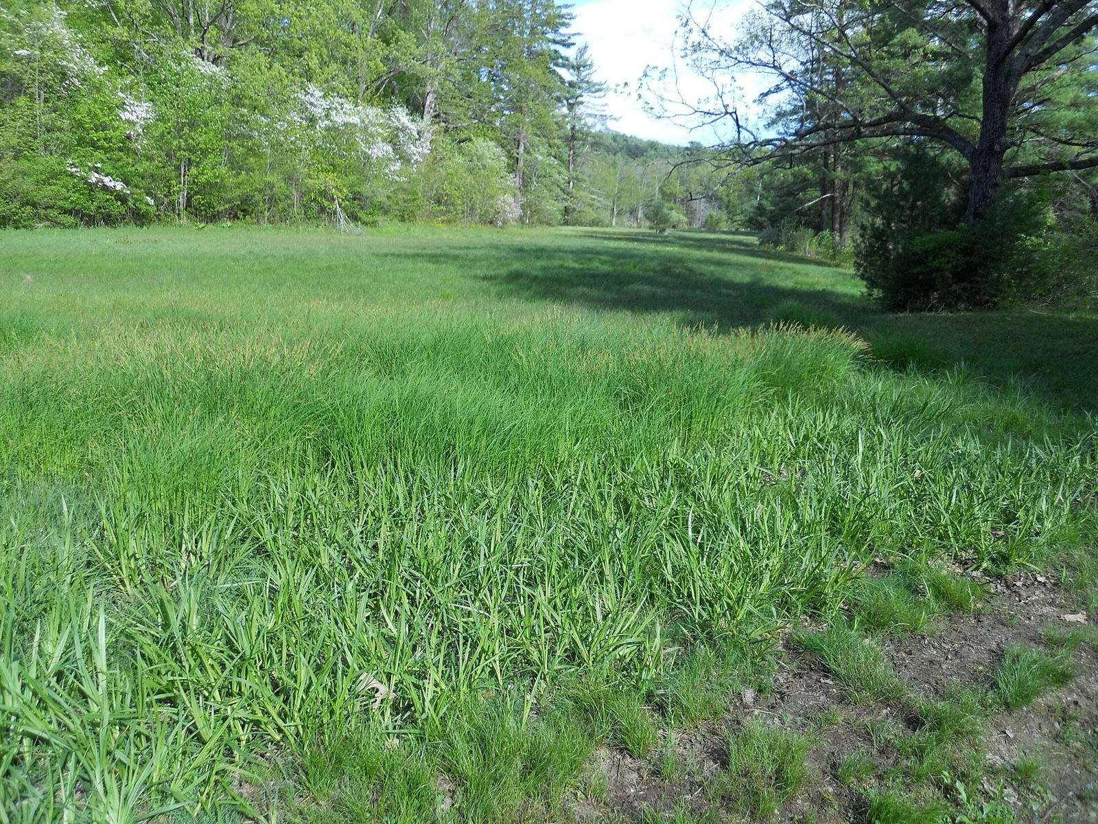
Maudslay State Park is a 480-acre state park at 74 Curzon Mill Road in Newburyport, Massachusetts, run by the Massachusetts Department of Conservation and Recreation (DCR).It was the Moseley family's country estate, and it still has the estate's 19th-century gardens and plantings, rolling meadows, towering pines and what DCR calls one of the largest naturally occurring stands of mountain laurel in Massachusetts. There are 16 miles of trails for walking, biking, horseback riding and cross-country skiing. It is open sunrise to sunset, every day of the year.
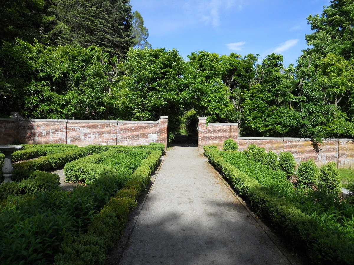
DCR's own trail map describes it as a former estate with sweeping views of two rivers: the Merrimack along the north edge and the Artichoke on the west. No mansions remain. The main house was torn down in 1955 and a second family house burned in 1979, but the bones of the estate are still there: carriage roads, stone bridges, a flowering pond, formal gardens and old house sites you can walk to.
Parking costs $5 for Massachusetts plates and $20 for other plates, and DCR charges it all year here, not just in summer. Dogs are welcome on a leash. Swimming, fishing, fires and grilling, alcohol and motor vehicles are not allowed.
Maudslay State Park at a Glance
What to Do at Maudslay

Trails & Hiking
16 miles of carriage roads and footpaths through meadows, pine groves and old estate gardens, with three routes DCR suggests for a first visit.
Trail Guide →
Mountain Laurel & Gardens
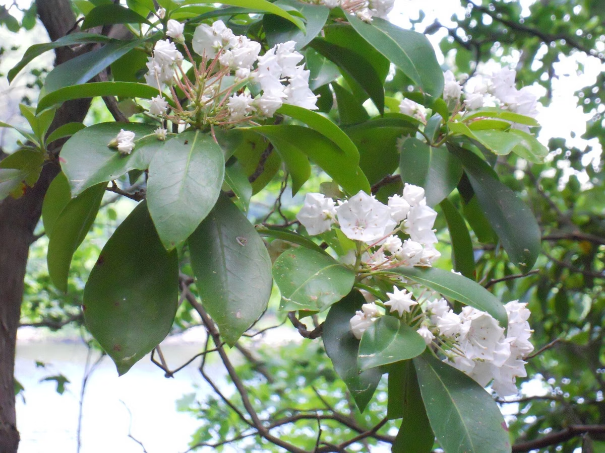
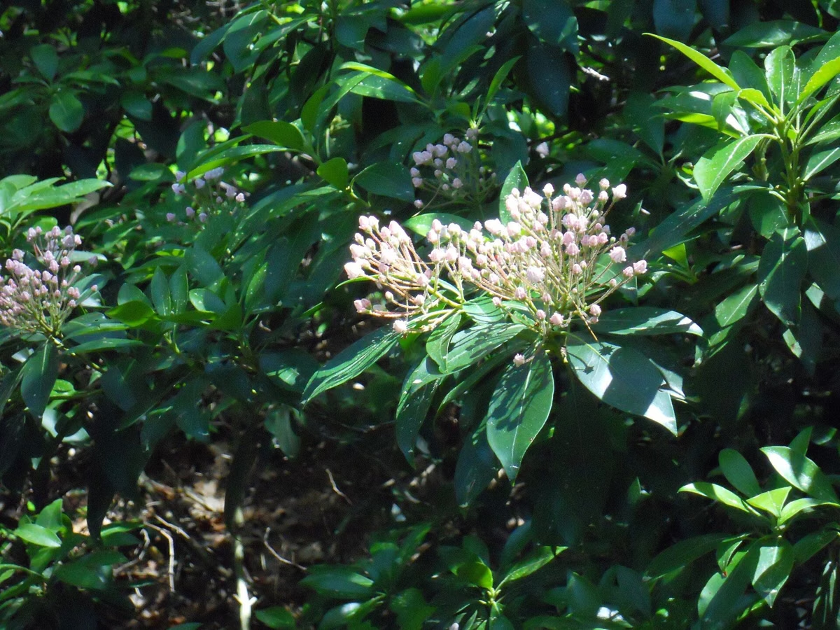
One of the largest natural stands of mountain laurel in Massachusetts, peaking around the third week of June, after weeks of azaleas and rhododendrons.
Bloom Guide →
Merrimack River Trail
DCR's signature hike: a 2-mile moderate loop along the river, around Castle Hill and back via Main Road and the Pasture Trail.
Route Details →
Horseback Riding
More than 5 miles of maintained bridle paths, plus multi-use trails to the east where horses are welcome on most paths.
Bridle Paths →
Cross-Country Skiing
DCR lists cross-country skiing among the park's activities, and its map marks which trails are open to skiers.
Winter Guide →
Weddings & Events
DCR names Maudslay among its most popular parks for weddings. Ceremonies need a DCR permit; the Maudslay Arts Center is a private venue on the grounds.
Permits & Venues →When to Go
Late May and June are Maudslay's showcase. DCR's bloom guide runs from dogwoods in the first week of May through azaleas and rhododendrons to the mountain laurel around the third week of June, and the formal gardens keep flowering into August. In fall, DCR says the landscape is ablaze with foliage and the open meadows give long views. In winter the trails are open to cross-country skiers, though DCR's map closes the Laurels area to the public from November 1 to March 31.
For a first visit, DCR suggests a 1–2 mile easy walk from the main lot: out the Pasture Trail, then either right across the three-arch stone bridge into the pines and laurels, or left onto the Long Border Trail for the old gardens. With more time, take the 2-mile Merrimack River Trail.
Programs
DCR runs free interpretive programs at Maudslay, from history hikes to Castle Hill and Bootlegger's Field to a preschool nature hour. Most meet at park headquarters at 74 Curzon Mill Road. Call the park at (978) 465-7223 to confirm, since weather can cancel a program.
Nearby on the Coast
Maudslay is a woods-and-gardens park with no beach. For sand and surf, DCR's Salisbury Beach State Reservationsits across the river mouth, and Plum Island has a city beach at its north end, theParker River National Wildlife Refuge in the middle and DCR's Sandy Point at its southern tip. Downtown, the Clipper City Rail Trail loops around Newburyport. More inthings to do in Newburyport.
How Far Is Maudslay State Park?
One lot, on Curzon Mill Road in Newburyport. Drive times from four nearby cities, a map of the park and today's weather.
| From | Miles | Drive (typical, no traffic) |
|---|---|---|
| Boston, MA | 36.6 | 51 min |
| Portsmouth, NH | 22.8 | 34 min |
| Manchester, NH | 46.4 | 1 hr 3 min |
| Providence, RI | 86.5 | 1 hr 56 min |
Each drive ends at the Main Lot on Curzon Mill Road, the parking area OpenStreetMap pins at 42.8215, -70.9264. We measured each trip on 2026-11-08 with the OSRM routing service over OpenStreetMap roads, starting at the city hall and ending at the main lot. The minutes assume an open road with no traffic. DCR itself gives no drive times.
Turn-by-turn from each cityTrail Map
An approximate park outline traced from OpenStreetMap, with the main lot pinned. OpenStreetMap drew the boundary; DCR did not publish one.
See the map guideToday at Maudslay
- ForecastLoading...
- Wind and rain chanceLoading...
- Sunrise and sunsetLoading...
Forecast: National Weather Service. Read in your browser, nothing stored.Full forecast at weather.gov
Maudslay State Park FAQ
Is Maudslay State Park free?
Walking in is free, but parking is not. DCR charges $5 a day for cars with Massachusetts plates and $20 for other plates, and at Maudslay the fee applies year-round. A DCR annual pass or a lifetime senior pass covers it.
Are dogs allowed at Maudslay State Park?
Yes. DCR allows dogs at Maudslay as long as they stay on a leash, and its hiking guidance sets a 10-foot maximum leash and asks you to pick up after your dog.
Can you swim at Maudslay State Park?
No. Swimming is on DCR's list of restrictions for Maudslay. For a swim nearby, Salisbury Beach and Plum Island are both on the coast a short drive east.
When do the mountain laurels bloom at Maudslay State Park?
DCR's bloom brochure puts the mountain laurel peak at about the third week of June. Dogwoods start the season in the first week of May, and rosebay rhododendrons finish it in the last week of June.
What are the hours at Maudslay State Park?
The park is open sunrise to sunset every day, all year.
How long does it take to drive to Maudslay State Park?
Measured with road routing from each city hall and no traffic, it is about 34 minutes from Portsmouth, NH, 51 minutes from Boston, 63 minutes from Manchester, NH and just under 2 hours from Providence. The parking page has the miles and the roads.
Who owns Maudslay State Park?
The Commonwealth of Massachusetts. The land was the Moseley family's estate; the state acquired it in 1985, and DCR runs it today.